Geology

Geology
The 366 daily episodes in 2014 were chronological snapshots of earth history, beginning with the Precambrian in January and on to the Cenozoic in December. You can find them all in the index in the right sidebar. In 2015, the daily episodes for each month were assembled into monthly packages (link in index at right), and a few new episodes were posted from 2015-18. You may be interested in a continuation of this blog on Substack at this location. Thanks for your interest!
Showing posts with label Cretaceous. Show all posts

Sunday, March 4, 2018

Cretaceous and Cenozoic Vertebrates compilation


Smilodon and dire wolves (drawing by Robert Horsfall, 1913)

Running time, 1 hour. File size, 69 megabytes.

This is an assembly of the episodes in the original series from 2014 that are about Cretaceous and Cenozoic vertebrates.

I’ve left the references to specific dates in the podcast so that you can, if you want, go to the specific blog post that has links and illustrations for that episode. They are all indexed on the right-hand side of the blog.

Thanks for your interest and support!


Tuesday, December 26, 2017

Episode 380 Makoshika State Park, Montana


The badlands at Makoshika State Park are in Montana, and so am I, but Montana’s big. The park is just outside of Glendive, almost at the eastern border of the state. It took me and my friend about seven hours to get there from Butte, but it was worth it.

Eastern Montana is quite different from western Montana, geologically. The west is broken, thrusted, pulled apart, and intruded, while the east is – with exceptions – largely more or less flat-lying, relatively undisturbed sedimentary rocks piled upon each other, with the oldest at considerable depth and the younger rocks at or near the surface.

At Makoshika, the rocks are from the last part of the Cretaceous Period and the early part of the Cenozoic Era, what we used to call the Tertiary. So the famous K-T boundary, the extinction point for the dinosaurs and a lot more, is in these rocks. Nowadays we call the earliest period of the Cenozoic the Paleogene, and if you’re really interested in the story of the names of the Cenozoic periods, check the podcast episodes from early December 2014.

Erosional features in the Fort Union Formation at Makoshika.
Photo by Dick Gibson.
There’s actually a coal bed near the K-T boundary at Makoshika, but the coolest thing about the rocks in my opinion is their weird and fanciful erosional shapes. The younger Tertiary rocks, the Fort Union Formation, are alternating sandstones and siltstones and shales, with a wide range of cementation, so the rocks respond to erosion very differently. Some erode easily while others stand out in rugged relief. Erosion creates pedestals and balanced rocks, natural bridges and sharp ridges, as well as softer slopes incised by rivulets large and small when it rains.

The sediments that came to make up the Fort Union Formation were deposited in rivers, lakes, and swamps around 65 to 60 million years ago, Paleocene time. There’s a bit more about the Fort Union Formation in the episode for December 4, 2014, which you can find on the blog, history of the earth calendar.blogspot.com, together with transcripts for this and older episodes. The Fort Union Formation’s rocks included many highly vegetated swamps which over time dehydrated and were compressed into thick coal beds, among the most important coal producers in the United States today. U.S. demand for coal is decreasing, as cheaper, more abundant fuels for generating electricity, most notably natural gas, are used more, but in 2017 burning coal was still the source for about 30% of US electricity. Just ten years ago, that proportion was close to 50%. Coal mines in the Fort Union Formation in Wyoming, south of Makoshika, produce about 40% of all US coal.

The Cretaceous rocks underlying the Fort Union Formation are similar kinds of rocks, but they contain dinosaur bones, especially further west, and they’re called the Hell Creek Formation. Triceratops and Tyrannosaur fossils have been found in the Cretaceous rocks at Makoshika, along with a nearly complete Thescelosaurus, a small, 10-foot-long probable herbivore discovered in 1997.
The name Makoshika is from the Lakota words maco sica, meaning 'bad land' or 'land of bad spirits,' but despite that I find the land remarkably beautiful. One of the reasons the landscape displays such spectacular erosional features is the fact that this area is gently uplifted. The Cedar Creek Anticline, a long, linear fold above a deep-seated fault trending northwest through this part of southeastern Montana, reaches its northern end near Makoshika.

You’d never think of this as a mountain uplift, but older, more erodible rocks of the Hell Creek Formation have been warped to the surface here, where wind and water have sculpted them for many thousands of years. Features like natural bridges and balanced rocks and delicately carved monuments are ephemeral in geologic terms, usually surviving for hundreds or a few thousand years at most. But they are continually replaced by other features, until the rocks with their variable resistance are all gone, washed down the rivers. That happens eventually, even in semi-arid country like eastern Montana.

—Richard I. Gibson

Saturday, October 24, 2015

The Cretaceous Episodes


Running time 2 hours 30 minutes

We are up to the Cretaceous Period of the Mesozoic Era in the monthly episodes. This one combines the 30 episodes from November 2014, covering the Cretaceous, into one episode.

As usual for this monthly compilation, I’ve left the references to specific dates in the podcast so that you can, if you want, go to the specific blog post that has links and illustrations for that episode. They are all indexed on the right-hand side of the blog.

If you have questions or comments, please let me know, either here on the blog – there’s a page for Questions – or contact me by email at rigibson@earthlink.net. I’ll try to respond. You can of course also leave a review on iTunes. I really do appreciate your feedback.

—Richard I. Gibson

Monday, August 10, 2015

Episode 373. A walk to Branham Lakes


Upper Branham Lake
Today’s episode will be a little different from what you are used to. I’m going to try to give some of the story of the Precambrian here in southwestern Montana, but I’ll do it in the context of a little hike I did yesterday to the Branham Lakes in the Tobacco Root Mountains. So there will be some of the usual narration, but also some snippets that I recorded while I was on the walk, which are not included in the script below. You can expect some huffing and puffing. See also this blog post by Pat Munday.

probably hypersthene (Mg Fe silicate)
When I was learning the geology of this region back in 1969, the Precambrian rocks of the Tobacco Root Mountains were considered to be Archean, older than 2.5 billion years. They were (and are) the northwestern-most corner of the Wyoming Craton, one of the ancient, fundamental building blocks of North America that we talked about last year. And the Wyoming Craton is definitely Archean in age. At least most of it is.

More recent analyses of age dates in southwestern Montana gave rise to another interpretation, by Tekla Harms and her colleagues a few years ago, that the zone through the Tobacco Roots, Highland Mountains south of Butte, and Ruby Range east of Dillon, Montana, represents the old margin of the craton, where a pile of sedimentary rocks formed – possibly during Archean time, but if it was then, it wasn’t long before the 2.5-billion-year cutoff date for the Archean. The sediments might have been early Proterozoic, called Paleoproterozoic. In any case, Harms and colleagues interpret age dates in some of these rocks at about 1.75 to 1.9 billion years to represent the collision between the northwestern corner of the Wyoming Province and another terrane, now mostly in the subsurface of central Montana. There isn’t much doubt that such a collision happened, but there remain questions as to whether the Precambrian metamorphic rocks of southwestern Montana were already there, Archean, or if they were sedimentary rocks that got caught up in that collision and metamorphosed a few hundred million years after they were deposited.

Geologic Map of part of the Tobacco Root Mountains. Reds and oranges are igneous rocks of the Tobacco Root Batholith, about 75 million years old. Grays are Precambrian rocks, about 1700 to 2500 million years old. Both maps from Vuke et al., 2014, Geologic Map of the Bozeman quad, Montana Bureau of Mines and Geology Open-file map 648. Black box in lower left corner is enlarged below. 
Oranges (Khto) are Tobacco Root Batholith, grays are Precambrian. X=Paleoproterozoic, about 1.7 to 1.9 billion years old; A = Archean, over 2.5 billion. XA means we aren't really sure. qfg = quartzofeldspathic gneiss, ah = amphibolite and hornblende gneiss. Xsp = Spuhler Peak formation. Branham lakes are blue. 
There isn’t much doubt that the metamorphic rocks there were originally mostly sedimentary rocks, sandstones, shales, siltstones, maybe even a few limestones, and that they were intruded by some igneous rocks like basalt, all before they were metamorphosed. We can infer what these protoliths, the original rocks, were, from the chemistry and mineralogy of the rocks today. So it’s a question that doesn’t matter too much, although it has big implications for the detailed story of this part of the world – when were sediments laid down, when were they metamorphosed. That in turn has implications for the structural and tectonic history, and understanding THAT helps us explore for mineral resources and understand things like earthquake fault distributions.

I’m not going to solve the question by walking up to the Branham Lakes. This beautiful location is about 9 miles or so up Mill Creek, east from Sheridan, Montana.

Most of the major valleys on the flanks of the mountains of southwest Montana held glaciers during the most recent glacial period that ended about 12,000 years ago or so.


Kyanite, Aluminum Silicate
Sediments like silts and muds usually contain plenty of silica, fine-grained quartz, but often they have fragments of feldspars or the clays that weather from feldspar, and those minerals contain a lot of aluminum. Under metamorphic conditions, high temperatures and pressures, the aluminum and other chemicals reorganize into minerals that are stable at those temperatures and pressures. There are three minerals, kyanite, andalusite, and sillimanite, which are chemically identical aluminum silicates, Al2SiO5, but which have different crystallography that reflects the details of the pressure-temperature regime in which the aluminum and silica were mobilized. Kyanite is stable at relatively low temperatures, 200 to 700°C, and low to high pressures; Andalusite forms at low pressures and medium temperatures, and Sillimanite forms at high temperatures across a range of pressures. The boundaries between these phases are well known so we can use their occurrence to infer the temperatures and pressures that the rocks reached during metamorphism.

Tobacco Root Batholith granite with dark xenolith of older rock
The Archean and early Proterozoic metamorphic events, about 2.5 billion to maybe 1.7 billion years ago, were ancient when the next potential metamorphic event took place, about 76 million years ago.

In the next clip, I made a mistake – I say epidote when I meant to say enstatite. They both start with an E, that’s my excuse! Enstatite is magnesium silicate, and hypersthene, also mentioned in the next clip, is enstatite with iron in it. Both are the kinds of minerals you can get by metamorphosing rocks that have a lot of iron and magnesium, probably NOT simple sediments like shale.

The road to the Branham Lakes, about 9 miles from Sheridan, Montana, is pretty good, and you could probably make it almost all the way in a 2-wheel-drive vehicle if you have decent clearance. I chose to leave my Prius about 2½ miles from the lakes just to be safe, as there are a few dicey stretches, and because it was such a fine day I really preferred to walk. If you go, it would be an unusual year that you’d find the road and lakes snow-free before late June at the earliest, but the setting is spectacular in July and August. I have a few photos from my walk on the blog, history of the earth calendar dot blogspot dot com.

I hope you have enjoyed this little ramble from the Precambrian to the Cretaceous to the glacial period of the Pleistocene. Thanks for listening!

Lower Branham Lake

—Richard I. Gibson

More photos on Facebook

Sunday, November 30, 2014

November 30. It’s the end of the world as we know it….


The end of the Cretaceous – and the end of the Mesozoic Era – were marked by a mass extinction, one of the largest in earth history. Unlike some of the earlier extinctions, we pretty much have a smoking gun for this one: the impact of an asteroid in what is now northwestern Yucatan, Mexico. 

Not that it was an easy sell. Since I was a grown-up geologist in the early 1980s when the team led by Luis Alvarez and his son Walter began to suggest the impact as the cause of the extinction, I remember some of the controversy. It was a radical idea; any kind of catastrophe flew in the face of the long-accepted idea of uniformitarianism, that changes on earth resulted from the application of slow, steady changes over long, long times. I’m really not sure why the idea that catastrophes DID happen was so hard to accept, but it was. The Alvarezes were ridiculed in some professional circles. But accumulating evidence really pretty rapidly, in just a few years, convinced I would say all but a few geoscientists of the validity of the impact as at least a major factor in the extinction. 

Gravity map of Chixulub crater (source: NASA)
The evidence includes a layer around the world right at the top of the Cretaceous, coinciding with the extinction, of iridium, an element that’s abundant in asteroids. Shocked quartz grains are present as well, and result from impacts. Rocks of the right age in Texas and elsewhere in the Gulf of Mexico and Caribbean region look like gigantic tsunami deposits. And finally, magnetic data being analyzed by geophysicist Glen Penfield for oil exploration in Yucatan defined a likely crater on the northwestern coast of the peninsula. It took a while for the age of the Chicxulub impact crater to be determined accurately, but now it is considered to have happened at 66.04 million years ago. It is within 33,000 years of the best estimate for the extinction event, so practically, the two are simultaneous. The Chixulub crater shows up nicely in gravity data too, and even today the cenotes, natural sinkholes scattered across Yucatan, follow the crater margin even though it is deep in the subsurface.

The potential effects of such an impact can be estimated from the size of the crater and the impact angle. Vast quantities of dust, ash, and aerosols likely went into the atmosphere, creating toxicity as well as probably a nuclear winter; it’s been speculated that most of North America burned in an incendiary forest fire across the continent.

The effects resulted in the destruction of about 75% of all species on earth. The most famous victims are the non-avian dinosaurs, all of which perished. All the ammonites died. The giant marine reptiles and the pterosaurs were gone. Pretty much every group, including things like mammals and birds that survived as a class, lost many members. Everything from plankton to plants to snakes and turtles suffered. Surviving birds and mammals did undergo a dramatic diversification and radiation soon after the extinction – a typical reaction, as the survivors adapt and expand into niches vacated by other animals.

While it’s pretty much agreed that the impact was a major factor in the extinction that ended the Mesozoic, there’s still debate about whether it was the only factor. Other things were going on that might have had roles. We’ve talked several times in this series about massive volcanism as a possible factor in extinctions, especially the Siberian flood basalts at the end of the Permian. From about 68 to 66 million years ago in India, similar flood basalts erupted to create the Deccan Traps. Before the asteroid impact was known, the Deccan was usually seen as the gradual, 2-million-year cause of the extinction. There are some declines in diversity among several groups, including some dinosaurs, that may be related to an ongoing effect of the Deccan. The asteroid might have simply been an exclamation point on an already-in-progress extinction. Besides the Deccan volcanics, there were other ongoing climate changes that could have had a role in the general decline and ultimate extinction.

There was also a sharp regression or sea-level drop during the Maastrictian, the last epoch of the Cretaceous. It’s not clear what might have caused that fall in sea level, but other extinctions have been tied pretty clearly to such activity.

So the impact is pretty well accepted as the killer. It’s possible that there were actually multiple impacts. Craters in various parts of the world, from the Ukraine to the North Sea to India are dated to within a few million years of the Cretaceous extinction. There’s a well-known crater in Iowa, the Manson Crater, but it is now dated to about 74 million years ago, too early to have much effect 8 million years later.      

—Richard I. Gibson


The K-T extinction (Richard Cowan) 
Long-term climate stress caused extinction 
Single impact killed dinosaurs

Chixulub gravity map from NASA (public domain)

Saturday, November 29, 2014

November 29. Verkhoyansk fold belt


A handful of people have asked about donations to be sponsors for the podcast. That’s really not on the list; the budget for the whole production is about $39- $35 for the digital voice recorder, plus $4 for replacement AAA batteries. I was trying to make it through the whole year on the first set of batteries, but the originals died the other day. Otherwise, there’s no cost other than my time. I hate commercial announcements enough, even on public broadcasting, that I’m not interested in accepting sponsors for this podcast. I’m not rich, but I can afford to do this, and it’s really a labor of love. Thanks for your support.

Likewise, I’m not in it for the clicks. I’m glad to see my statistics showing 4,000 pageviews per month on the blog, and as near as I can tell, about 1,000 downloads a day of the podcast, but I’d keep doing it if those numbers were 100 people I don’t know. I don’t do much to promote the podcast other than getting it listed on iTunes and other providers, so it is what it is. Clearly a lot of people find it through search engines. Again, thanks for your support and interest.

To repeat my disclaimer, I’m not an expert in everything – I like to think of myself as a geological generalist, although of course I do have specialties, strengths, ranging from kidney stone mineralogy to gravity and magnetics in oil exploration. Please take these podcasts or the blog as summaries of the topics. I try to be even handed and unbiased, but I don’t guarantee that. If something I talk about strikes your fancy, by all means, investigate more! There’s a vast amount of information out there on everything I talk about. Or feel free to ask me questions. I’m happy to say “I don’t know,” but like most geologists, that won’t stop me from expounding on something – but I’ll try to make it clear that I may be approaching the topic from a point of general knowledge but specific ignorance. 

* * *

So on to today’s Cretaceous topic – the Verkhoyansk Fold-Thrust Belt. We talked a lot about the collision on the west coast of North America that formed much of the basis for the modern geography of the Rocky Mountains, including such details as oil fields. Similar things were happening in other parts of the world during the Cretaceous too.

The tectonic framework of far eastern Asia is really a mess. There were microcontinents, island arcs, entrapped oceanic crust, and more, all becoming amalgamated to what we think of today as the far eastern part of Eurasia. One aspect of it that is moderately well documented is the collision between a small, almost circular microcontinent called the Kolyma Block and the eastern side of the Siberian Craton.

Tectonic Map of far eastern Siberia (Khain, 1973)


The Siberian Craton is one of the really old, fundamental continental blocks, like the Superior Craton in North America or the Baltica Craton in Europe. By the Cretaceous, it was firmly attached to Europe and the Kazakhstan Craton, so the concept of Eurasia was a reasonable one at that time. The details were still in progress, especially on the eastern and southern margins of the young Eurasia.

What I’m saying about this collision and fold belt is based in part on my own work on the magnetic map of the former Soviet Union. The Kolyma Block, that I’m calling a microcontinent, has a magnetic character that’s a lot like Kansas or Texas – magnetic character that says it’s probably Precambrian crust, but the Kolyma Block was a relatively small, independent block, not part of a major continental terrane until the Cretaceous.

This eastern margin of Siberia was for millions of years a passive margin – like the Atlantic coast of North America today, with lots of various sedimentary units accumulating. The rocks are as old as Cambrian, but most of the sedimentary pile is Carboniferous to Jurassic in age. Beginning in late Jurassic time and continuing into the Cretaceous, the Kolyma block began to collide with Siberia, pushing the older passive-margin rocks against the strong buttress formed by the Siberian craton. The collision was intense enough to have some subduction that produced granites, but the main expression today is the 400-kilometer-wide Verkhoyansk Fold Belt.

Present-day plate-tectonic context of
Verkhoyansk fold belt (base from USGS)
The collision was pretty much done by around 90 million years ago, the early part of the late Cretaceous. The rest of eastern Siberia was added even later. Today, most of this area and the region to the east is actually tectonically a part of North America. The boundary between Eurasia and North America is along a rift zone in the Arctic Ocean, called the Nansen Cordillera, an extension of the Mid-Atlantic Ridge. The boundary is not well-defined as it continues into Asia about where the Lena River enters the Arctic Ocean, but it extends on south along Sakhalin Island and to the northern part of Japan. The great earthquake offshore Japan, March 11, 2011, was located pretty close to the intersections of the boundaries of the North American, Eurasian, and Pacific Ocean tectonic plates. So even though the boundary is pretty much inactive where it goes through the Verkhoyansk Fold Belt, that Cretaceous heritage is still affecting tectonic activity in the region today.
—Richard I. Gibson

Reference: Defining the eastern boundary of the North Asian craton from structural and subsidence history studies of the Verkhoyansk fold-and-thrust belt, by A.K. Khudoley and A.V. Prokopiev, in Whence the Mountains?: Inquiries Into the Evolution of Orogenic Systems : a Volume in Honor of Raymond A. Price, edited by James W. Sears, Tekla A. Harms, C. A. Evenchick. Geological Society of America Special Paper 433, 2007.

Reference: U.S. Geological Survey Professional Paper 1626, 2000: Phanerozoic Tectonic Evolution of the Circum-North Pacific, by Warren J. Nokleberg, Leonid M. Parfenov, James W.H. Monger, Ian O. Norton, Alexander I. Khanchuk, David B. Stone, Christopher R. Scotese, David W. Scholl, and Kazuya Fujita

Friday, November 28, 2014

November 28. Triceratops


Besides Tyrannosaurus rex, the iconic dinosaur of the Cretaceous is probably Triceratops – or to be specific, Triceratops horridus to give the best known species its full name. Triceratops was a contemporary in time, the very late Cretaceous, 68 to 66 million years ago, and space, the margins of the Interior Seaway in western North America, with Tyrannosaurus. Tyrannosaurs were the principal predators threatening the herbivorous Triceratops.

Triceratops, whose name means ‘three-horn-face,’ was a ceratopsian, a group that includes dozens of families. What they had in common was complex ornamentation on their skulls, ranging from ornate frills to horns to fancy spines. They also typically had beak-like mouths.

Triceratops fossils were discovered near Denver, Colorado, in 1887. Paleontologist O.C. Marsh initially misidentified the age of the rocks it was from, and thought it was a Cenozoic mammal, but within a year additional specimens and more information led him to recognize its Cretaceous age and dinosaurian nature, and he named it Triceratops.

The role of the frills and other complex ornamentation has been debated over time. Some researchers considered them to be aspects of temperature regulation, like the sail on the back of the Permian Dimetrodon, but this idea is not the favored one. Display – for defense, or for sexual competition or courtship, or all three – is I think the consensus explanation for the wide variety of distinctive appearances among ceratopsians. Support for the idea that the frills might be used in combat, either against predators like Tyrannosaurs, which are known to have fed on Triceratops, or in sexual combat, comes from the nature of the bony tissue in the frills. It’s a type that heals rapidly, helping seal wounds.

Triceratops grew to 8 or 9 meters in length, 26 to 30 feet. Its skull was among the largest of any dinosaur, or any land animal, presumably big to support the complex bony ornamentation and horns. The earliest ceratopsians appeared in the Jurassic. They had pretty minimal skull decorations, and it was not until the early part of the Late Cretaceous that the first horned, frilled ceratopsians developed. Enough specimens have been found that we now see the evolutionary process that led to Triceratops as one that took at least a couple million years, as reported by researchers at Montana State University in June 2014.

Ceratopsians comprise one of the major lineages of the dinosaurs. They’re not especially close to the Sauropods, but I’ll end this episode with a note about the Sauropods. Just recently, in 2011, the first discovery was announced of sauropod fossils from Antarctica, reported by a team of Argentinean scientists. This confirms the global distribution of the gigantic herbivorous Sauropods by Late Cretaceous time, at least. During the late Cretaceous, Antarctica was near the south pole, and except for an increasingly tenuous connection to Australia, it was isolated from the other continents. Dinosaurs truly were worldwide in their range.
—Richard I. Gibson

Links:
Sauropod in Antarctica 

Triceratops' horns developed over millions of years

Thursday, November 27, 2014

November 27. The Athabasca Tar Sands


The McMurray Formation is a package of Cretaceous rocks in northern Alberta and adjacent areas of Canada that was laid down in early Cretaceous time, so I should have talked about it earlier this month, but I didn’t. 

The basin that the McMurray sediments accumulated in was an early aspect of the Cretaceous Interior Seaway that reached its height in Late Cretaceous time. The sea invaded from the north, the Arctic, so the transgression of the sea affected Canada earlier than it did the western United States. The McMurray environment was similar to that of the shores of the later Cretaceous Interior Seaway – rivers, deltas, estuaries, and coastal plains. Settings like that typically give rise to interbedded and alternating sands in river channels and beaches, silts in the more distant parts of deltas and estuaries, and muds in overbank deposits, flood plains, and in the parts of the coastal sea even more distant from shore. 

What makes the McMurray special is that it holds one of the largest accumulations of hydrocarbons in the world – the Athabasca Tar Sands. You sometimes hear this called oil sands, but it really isn’t oil in the sense of liquid oil. It’s solid bitumen, tar, oil that has lost the volatile components that help make oil liquid. It’s called the Athabasca Tar Sands because the McMurray formation crops out in the drainage basin of the Athabasca River.

Map by Norman Einstein, released to public domain.
There’s an estimated 1.7 trillion barrels of hydrocarbon in place in these deposits, similar to or more than all the rest of the known conventional oil in the world. Only about 179 billion barrels is listed as economically producible – but that’s “only” about the same as all the oil in Saudi Arabia.

This stuff, because it is solid, is a lot harder to produce. About half of production is mined, dug out of the outcrop, and the rest is produced using steam injection and other methods to essentially melt the material in the subsurface to liquefy it. All methods combined yield about 2.3 million barrels of oil per day – more than half of Canada’s total oil output. Canada is the #5 oil producer in the world, after the U.S., Russia, Saudi Arabia, and China, and Canada is the leading source of U.S. imports, at more than 3.5 million barrels per day – more than all OPEC nations combined. Canadian imports amount to more than one-third of all US imports, which totaled about 9.2 million barrels a day in September 2014, and Canadian imports made for about 19% of total US consumption, which is just over 19 million barrels a day.

Canada projects that it may be able to double its production of oil from tar sands by 2020.

Leaving apart the controversies over this production, I’m going to focus on the origin of the deposit. I used to think it was more or less just an oil reservoir at the surface with the volatiles gone, but it’s more complicated than that.

First, there’s the question of the source rocks for the bitumen. The most common speculations for source rocks include marine Devonian carbonates or Triassic-Jurassic shales, or both. Those rocks are known to be the sources of conventional oil in the Western Canada Sedimentary Basin, but they may be inadequate to generate the volumes we see in the tar sands. It’s been suggested that they formed in place, from organic matter washed into the McMurray formation along with the sands and shales, or that it was derived from non-marine Jurassic and Lower Cretaceous coals.

There’s also argument about the migration history – how the bitumen got there – ranging from in-place formation to migration from deep sources. The process was complicated by dissolution and collapse of salt-bearing horizons in the Devonian. Their collapse changed the topography of the surface the McMurray sands were deposited upon, so that some places had thicker sands than others, and were more favorable for the oil and bitumen to accumulate.

Agreement is not unanimous, but I think there’s at least a slight preference for the Jurassic Fernie formation, a black shale, as the ultimate source of the organic matter. It would have migrated in a fairly standard way, and then it would have to be degraded, driving off the volatiles to leave the heavy, viscous tarry stuff behind in the sand reservoir. The standard view of degradation of oil to make bitumen is that it’s driven mostly by bacterial action – microbes consume the lighter, more volatile compounds in the oil and leave the tar behind. That certainly happens, but it begs the question of why did it happen on such a massive scale here in Canada. Even the weight of glacial ice on the reservoir may have been a factor in the degradation of the oil from a fluid to the bitumen, or from solid coal to tarry stuff.

There are lots of other tar sands and accumulations of heavy oil around the world, but the one in Canada and the one in Venezuela – which may be even slightly more voluminous than the Canadian deposits – are by far the largest.
—Richard I. Gibson

LINKS:
Geologic features of tar sands 
Geology of the Oil Sands (PDF)
Origin of the tar sands 

Western Canada Basin oil – Jurassic sources

Canadian oil 

Map by Norman Einstein, released to public domain.

Wednesday, November 26, 2014

November 26. Birds


The Cretaceous Interior Seaway of western North America was a great abode for life, both in the waters and on the adjacent tropical or subtropical lands. You remember the chalk cliffs of Dover, England – the chalk that gave the name to the Cretaceous, which means “chalk-bearing”? The North American interior seaway also contained a lot of those microscopic coccolithophores whose shells accumulated to make chalk. 

Probably the most famous example is the Niobrara Chalk, a prominent part of the Cretaceous stratigraphic section especially in Nebraska and Kansas which were under the waters of the seaway. Most of the fossils from the Niobrara are, as you’d expect, marine fossils – fish, turtles, plesiosaurs. But it also contains occasional land-dwelling dinosaurs, whose bodies must have been washed offshore, and there are winged vertebrates as well.

Pteranodons, winged reptiles that are not dinosaurs, flew in the late Cretaceous skies above and near the western interior seaway and what is now the Gulf Coastal Plain around 85 million years ago. Despite their relatively short existence, probably not much more than two or three million years, they are well known because more than 1,200 specimens have been found, the most of any pterosaur. “Pteranodon” means “winged, toothless,” and they had typical wingspans of 6 meters, about 20 feet.

Pteranodons shared the skies with birds, which were becoming much more diverse during the Cretaceous. Ichthyornis was a small toothed bird that probably occupied ecological niches similar to gulls. Many specimens of Ichthyornis have been found in the Niobrara Chalk. Its time range is about 95 to 85 million years ago, and it is interpreted to be of a bird lineage that was near that of modern birds, but it was probably not a direct ancestor to them. Its name means “fish-bird,” and it’s among the best-represented birds in the fossil record – but “well represented” probably means a few hundred specimens, not thousands. 

Hesperornis fossil (Smithsonian) photo by Quadell, used under Creative Commons license

Hesperornis, whose name means “western bird,” was a flightless bird – based on its size, its wings were useless for flight. It was most likely a penguin-like, or more accurately loon-like, fully aquatic bird, demonstrating that birds had evolved and adapted to the marine realm as early as 84 million years ago. Hesperornis was pretty big, about 6 feet or almost 2 meters long. Its fossils have been found in Russia and Europe as well as many places in the western North American Interior Seaway, so as a group it clearly had a wide range.

Both Ichthyornis and Hesperornis were extinct well before the end of the Cretaceous, at about 85 and 78 million years ago, respectively.


—Richard I. Gibson

Ichthyornis
Hesperornis

Hesperornis fossil (Smithsonian) photo by Quadell, used under Creative Commons license

Tuesday, November 25, 2014

November 25. Tyrannosaurus rex


Obviously we can’t leave the Cretaceous without at least a mention of Tyrannosaurus rex. The tyrant lizard king – that’s what the name means – only lived during a relatively brief span of geologic time, a million years from 67 to 66 million years ago, just before the end of the Cretaceous. It was one of the largest land predators of all time, at 12 meters or 40 feet in length.

Henry Fairfield Osborn described the species from specimens collected at Hell Creek, Montana, in 1902 and 1908. Since then fossils from more than 50 individuals have been found. There’s enough individual variation that there are also specimens originally assigned to other species that were reassigned to Tyrannosaurus rex after further study, but there are also other species within the overall group of tyrannosaurids.

Photo of Sue, the most complete T. rex specimen known,
in the Chicago Field Museum,
by Connie Ma, used under Creative Commons license.  
They were bipedal carnivores, and the debate continues over whether they were active predators, scavengers, or both. Most researchers today seem to agree that Tyrannosaurus rex was an opportunist that both scavenged and caught live prey. It had a really strong bite that would force its teeth – up to 12 inches long – into pretty much whatever it wanted to bite.

Another current debate is whether T. rex was warm-blooded or cold-blooded. As near as I can tell, the jury is still out on that question.

The Hell Creek Formation, the rocks in which many T. rex fossils have been found, was laid down on the margin of the Cretaceous Interior Seaway that we talked about a few days ago. The setting was one of coastal flood plains and deltas, with rivers and some swampy areas. The climate must have been subtropical or tropical and clearly supported a wide range of life. There were lush forests of angiosperms, conifers, gingkoes, and cycads. Besides the famous T. rex, the Hell Creek Formation contains mammals, birds, pterosaurs, lizards, snakes, turtles, crocodilians, and a wide range of dinosaurs large and small. The more marine sediments contain fish, plesiosaurs, ammonites, sharks and rays, and there were snails, oysters, and clams in the marine and fresh waters. Lots of life, a long, tall food chain with carnivores like Tyrannosaurus rex at or near the top.

Tyrannosaurs only represent about 4% of the dinosaur fossils in the Hell Creek. The most numerous group were the Ceratopsians, horned dinosaurs, of which the most famous member is probably Triceratops, which we’ll talk about a little more in a few days.

There is of course a vast amount of information readily available about Tyrannosaurus rex. I have links below to a video and a podcast, both with Tyrannosaur expert Dr. Thomas Holtz who is at the University of Maryland, for more information.

—Richard I. Gibson

Video: The Life and times of Tyrannosaurus rex with Thomas Holtz 

Podcast link: New understanding 


Photo of Sue, the most complete T. rex specimen known, in the Chicago Field Museum, by Connie Ma, used under Creative Commons license.    

Monday, November 24, 2014

November 24. Mammals


Mammals diversified during the Cretaceous, so that by the end of the period, the two major modern groups, the placentals and the marsupials, were well established. Placental mammals include most modern types including rodents, primates – most every kind of mammal other than marsupials and the egg-laying monotremes, which are platypuses and spiny anteaters.

The mutituberculates were rodent-like mammals that got started during the Jurassic, thrived in the Cretaceous and survived the end-Cretaceous extinction, only to disappear in the Oligocene about 30 million years ago. Their 120-million-year run is the longest of any mammal lineage, and their diversity is reflected in at least 200 different species. Their name comes from their teeth, which have rows of little points, or tubercules. Although they occupied rodent-like niches, including burrows and trees, and were superficially much like squirrels and rats and other rodents, they are classed taxonomically in their own order, and they have no modern descendents. It looks like the true rodents displaced them in the early part of the Cenozoic Era, which we’ll talk about next month.   

Brian Switek has a post this week on a new Cretaceous mammal discovery, Vintana, a muskrat-like critter that lived in Madagascar a few million years after that island finally became separated from larger land masses. Madagascar had pulled away from Africa while it was still attached to India during the latter part of the Early Cretaceous epoch. India and Madagascar separated around 90 million years ago, and Vintana dates to about 70 million years ago, so it might be a reflection of evolution in the relative isolation of a small island continent. Check the Laelaps blog at phenomena.nationalgeogeographic.com for more information on this and many other fossil topics. 

Repenomamus with dinosaur bones in stomach –
photo by David Wong, used under Creative Commons license.  
The common view of Cretaceous mammals living in fear of dinosaur predators, creeping through the underbrush at night, was turned topsy-turvy by the discovery of a meter-long mammal in China, called Repenomamus. One specimen was found with fragments of a juvenile herbivorous dinosaur in its stomach. We don’t know if it scavenged, or chased small dinosaurs down, or maybe it preyed on the young. But it did eat dinosaurs. At a meter long, three feet or so, Repenomamus is the largest known Mesozoic mammal. Most Cretaceous mammals were around 3 to 10 inches long. Many are known only from a single tooth or a few bones, so they are not really very well known. Some spectacular exceptions exist, including an early Cretaceous mammal fossil from China in which the 4-inch-long animal’s fur can be clearly seen.

We’re coming up on the end of the Cretaceous in a week, and the last day of November will be devoted to the extinction event at the end of the period. I wanted to mention today some ideas that addresses the question of how mammals and birds survived the extinction event when, so far as we know, no dinosaurs did. One popular idea has been that birds and mammals in general were smaller in size than most dinosaurs, although there were a few exceptions at times. Smaller size would have allowed animals to maintain and regulate body temperature more easily, in the event of climatic extremes such as those that might have accompanied the end-Cretaceous extinction. And many mammals were burrowers, which would also afford protections from cold or other climate changes.

Mammal and bird brains might have become complex enough by the end of the Cretaceous, and more complex than the non-avian dinosaurs, so that as individuals and as groups they were simply more adaptable to the challenging conditions during the extinction event. Some mammals and birds did die off at the end of the Cretaceous, so it was most definitely not a case of all mammals and birds good, all dinosaurs bad.

The idea of long-term hibernation, say something like three-quarters of the year, has been offered as a way some mammals might have made it through a nuclear winter or other ecological catastrophe at the end of the Cretaceous. That might work for some, but certainly not for all mammals and birds. When it’s all said and done, a lot of the thought about mammal and bird survival at the end Cretaceous is largely common sense and reason – and nothing is certain yet to make it clear why they did survive.
—Richard I. Gibson

Repenomamus with dinosaur bones in stomach – photo by David Wong, used under Creative Commons license.  

Hibernation?

Surviving the extinction 

Laelaps blog

Mammals ate dinosaurs

Sunday, November 23, 2014

November 23. The Richest Hill on Earth


The subduction that became quite active in the Jurassic and continued into the Cretaceous and eventually created the Sierra Nevada Batholith was probably related to the two styles of mountain building we have talked about recently, the Laramide and Sevier Orogenies. The subduction itself was also complicated.

By Cretaceous time, some subduction was taking place much further east than the magmatic arc where the Sierra Nevada Mountains are today. It’s 750 kilometers, 450 miles, from Sacramento, California, to Boise, Idaho, but that’s about how far you have to go to find the continuation of the batholiths that resulted from Cretaceous subduction. In central Idaho, the granitic igneous rock is called the Idaho Batholith. It’s only about half as long as the Sierra Nevada Batholith – still huge, about 200 miles long, and generally it’s younger – formed about 100 to 54 million years ago, mostly Late Cretaceous, but some of it dates to the time a few million years after the Cretaceous ended.

Geologic map (from USGS, National Atlas) with batholiths emphasized.
Sierra Nevada is mostly Jurassic; Idaho and Boulder Batholiths
are mostly late Cretaceous in age.
Why is the Idaho Batholith so far east? There must have been a sharp break in the shape of western North America, or the stuff colliding, or both, to account for this. Because the Sierra Nevada and Idaho Batholiths are separated in time as well as space, there’s plenty of opportunity for things to change. Bottom line, subduction was taking place further east during Late Cretaceous time than it was during the Jurassic.

Even further east there’s an even smaller batholith in southwestern Montana, the Boulder Batholith. It’s only about 75 miles by 25 miles in size, extending from Helena, Montana to the Highland Mountains south of Butte. Butte, where I live, here in the Boulder Batholith, is today’s topic, because it holds “The Richest Hill On Earth.” That’s a nickname applied to the mineral district at Butte, and it might even be true. In the United States, there is no question – the US Geological Survey has calculated the value of the big mineral districts, and Butte is definitely the most valuable. It’s a little harder to say for sure in the entire world, because we don’t really know the value of mineral production from the Roman Empire, Incas, or whatever. But for one little mineral district, only about 6 square miles in area, it probably is the most valuable on the planet. I admit that I’m a little prejudiced about it, but still, it’s pretty likely.

There are rich metalliferous deposits scattered through the Rockies, the mountains of Mexico, and the Andes, all related to subduction of various oceanic plates beneath the North and South American continents. In terms of US production, Butte ranks #2 in copper, but #1 in produced copper plus reserves, #2 in silver, but #1 in terms of produced silver plus reserves, #6 in Zinc, and among the leading producers of manganese, lead, and molybdenum. It’s also produced large amounts of gold, cadmium, bismuth, and other metals. In terms of weight, Butte has produced about 24 billion pounds of copper, 5 billion pounds of zinc, almost 4 billion pounds of manganese, and almost three-quarters of a billion ounces of silver. That silver production probably places Butte third in the world, after Potosi, Bolivia, and Coeur d’Alene-Kellogg, Idaho.

Why? Why, within the 75 by 25 mile Boulder Batholith, is so much mineral wealth concentrated in a 6-square-mile area? The bottom line is, we don’t know. We know all sorts of things about how the veins formed, the way the mineral deposit is zoned, with more copper toward the center and more silver and zinc around the margin. We can talk about intersecting fractures that helped channel the hot waters carrying the minerals, concentrating them into this one area. But the ultimate question of why is unanswered. One idea suggests that in the subducting oceanic crust, there was a zone that was very rich in copper and the other minerals. It could have developed above a mantle hot spot that conveyed the minerals into the crust. This is happening today along many mid-ocean ridges, where things called black smokers are essentially underwater geysers on the sea floor, erupting superheated water rich in copper, zinc, and more, to deposit it on the sea floor. A long-lived system of black smokers might have put the mineral wealth into the oceanic crust that subducted. When it got hot, waters brought those minerals up into the overlying continental crust, where the rock melted, and when it solidified into granite, the last cracks got filled up with the mineral-rich veins.

Another possibility – and this is what I tell tourists when they visit Butte – is that it was just luck of the draw in the early earth. If the early, semi-solid earth was something like a plum pudding, with the plums representing blobs of minerals concentrated in spots that were distributed with no particular regularity, those blobs might still be hanging around, to some extent. They’ve been heated, partially melted, sliced and diced and faulted, uplifted and eroded, but still might be more or less in their original plums. About one-third of all the mercury known on the planet is in one deposit in Spain. I just don’t know of a reasonable way to concentrate all that mercury in one place – but it might have done so in the early almost molten earth, with mercury, or copper or whatever, coming together in a relatively few plum-like blobs.

In any case, there’s a great mineral wealth here in Butte. You recall that the word ‘batholith’ means ‘deep rock’ because the granitic rock solidified down in the earth – probably several miles down. It’s here at the surface today for the same reason the Sierra Nevada Batholith is at the surface – much later uplift and erosion to expose the once deep-seated granite. The volcanoes that were once above the granite, and much of the granite itself, have eroded away, so that the mineral deposit is now exposed at the surface. A happy circumstance for the prospectors who came here in 1864.

The Boulder Batholith cooled about 78 to 76 million years ago, and the mineral veins formed between then and about 61 million years ago, all in the last part of the Late Cretaceous. Big Butte, the eroded neck of an extinct volcano that gives the city of Butte its name, is from a later episode of igneous activity, about 49 million years ago, in the Cenozoic.

I have a link below to an article I wrote on this topic, called The Nature-Built Landscape: Geological Underpinnings of Butte. It’s a PDF of an article that appeared in the Vernacular Architecture Forum Guidebook.
—Richard I. Gibson

Links:
Geological underpinnings of Butte

Idaho Batholith 

Talk by John Dilles on the Geology of the Butte Mineral District

Saturday, November 22, 2014

November 22. Sevier Orogeny


A few days ago we talked about the Laramide Orogeny, the brittle breaking of the continental crust into huge uplifts along relatively high-angle faults with miles and miles of throw. And I mentioned a different style of mountain building that took place partially at the same time and in some areas, in the same places. That aspect of the deformation is called the Sevier Orogeny – and again that’s not “severe” but “Sevier,” from a place in Utah. Just to keep things confusing.


Sevier vs Laramide (source)

The basic difference between the Sevier part of the activity and the Laramide part is that instead of those big brittle breaks in the crust, in the Sevier we had much thinner slices of rock – mostly the bedded sedimentary rock – being pushed over each other in generally low-angle thrust faults with often only a few thousand feet of displacement, but sometimes more. This is the fairly typical result of collisions.

Think of a short pile of carpets and sheets and bedspreads all nicely on top of each other in horizontal layers. That’s the sedimentary package of rocks in western North America, ranging in age from Precambrian to the early Cretaceous. There’s been some bumping and breaking and so on, but on the whole, those carpets and sheets are still more or less intact and relatively horizontal. Now set a file cabinet on one side of the pile, and start pushing. The fabrics will fold and push up and over each other. In the real world of rocks, they are brittle enough to eventually break and slide over each other, and those breaks are called thrust faults. But the floor, the crystalline granitic rocks underneath the sediments, does not break. Well, it did in the Laramide Orogeny that we talked about the other day. But not in this more straightforward pushing we had during the Sevier Orogeny.

In the real world, as the rocks that are the equivalent of our carpets and sheets piled up on top of each other, two things happened. First, the tops start eroding, with the eroded sediments shedding off to the east of the uplifted, thrusted mountains. And second, the weight of the thrust sheets, plus the sediment, was enough to bow down the crystalline granitic floor. Not really enough to break it, but to make it sag.

We’ve just created a classic foreland basin. The foreland is the territory toward the craton, in this case the North American continent, inboard from the mountains created by the collision off to the west. The deepest part was in the west closest to the collision zone, where the thrust sheets and sediment piles were thickest, then it gets shallower and shallower, really pretty quickly, as you head east onto the strong craton.

We can see the evidence for this in changes in sedimentation from west to east. Here in Montana, where I live, along the Big Hole River, the Kootenai Formation of early Cretaceous age is something like 3,000 feet thick. Just 50 miles to the east, the Kootenai is about 400 feet thick. That change in thickness reflects the bottom falling out – the crust subsiding – in the western part of the foreland basin. To an extent it’s a self-perpetuating event: as more and more sediment and thrust sheets come in, the crust bows down more and more, allowing for more and more sediment to pile into the basin. Eventually, of course, it slows down or stops, once the collision has stopped and the mountains have been eroded to a level where they don’t contribute sediments in huge volume any more.

One important difference between the Laramide style and the Sevier style of mountain building is that the Laramide was pretty much a case of brittle breaking. The crust is thick, relatively uniform, and brittle, so it tends to break rather than bend. The sedimentary pile, on the other hand, was a package of diverse rocks that overall was a bit more plastic, and could fold before it broke. In detail, of course, there are brittle units and more plastic units – sandstones and limestones tend to be stronger and more brittle, and shales tend to be weaker and behave more plastically. Sometimes shales essentially even flow, because the rock is so weak and the particles are both small and mobile.

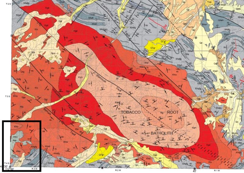
Part of the Sevier Orogenic Belt in Montana (USGS SIM 2860)
What this resulted in during the Sevier Orogeny was big folds, like the folded carpet pushed by the filing cabinet. They tend to be asymmetrical, reflecting the push direction, from the west, and most of them are above faults. Take your two hands, palm to palm, held horizontally pointing away from yourself. Push the upper hand over the flat of your lower palm, letting the ends of your fingers in the upper hand drag or stick on the lower palm as you push your upper hand away. The curl created in your upper hand is one of these folds, an anticline, and the surface of your lower palm is the fault surface.

Anticlines in general are excellent traps for oil and gas, if the other requirements are present, and in the Sevier Orogeny of western Wyoming everything came together. It’s called the fold and thrust belt there, with long, gently sloping thrust faults underlying big rounded anticlines, many of which hold oil and gas fields.

In other places along the Sevier Orogenic belt, the structure wasn’t enough – something was missing to make a hydrocarbon province, either source rocks, a seal, or something particular in the burial history to mature the organic matter into oil or gas. Consequently, for example, in the Montana Disturbed Belt, part of the Sevier Orogeny, there’s very little oil and gas. But the action did help create some spectacular scenery. The jagged alternating mountain crests of the Bob Marshall Wilderness in many cases reflect alternating thrust sheets. And all of Glacier National Park rides on one of the thrust faults, a special kind called an overthrust because it is very low angle, maybe 5° or less, and the rocks have been pushed over underlying rocks a great distance, tens of miles. The Canadian Rockies also are underpinned by Sevier Orogeny thrust faults, although like Glacier National Park, the sculpted mountains are the more direct result of glaciation in the last 2 million years or so.

I’ve said that there was some overlap in both time and space between the Sevier and Laramide styles of mountain building, but it’s fair to generalize some and say that the Sevier was mostly somewhat earlier than the Laramide, and generally took place to the west of the places deformed by the Laramide Orogeny. This makes sense if we buy the idea that an initial subducting oceanic slab, off to the west in what is now California and Idaho, began somewhat conventionally, with a magmatic arc and thrusted pieces pushing off the collision belt, followed by that change in the angle of the descending, subducting oceanic crust so that the forces were transmitted further east where they created the brittle breaks of the Laramide.

In places where the two types of deformation overlap, it can be challenging to unravel the sequence. Was a strong crystalline basement cored block already uplifted when the weaker, thinner thrust faults impinged on it? If so, the Laramide block might serve as a buttress, with the Sevier faulting swinging around it rather than through it. But you can get essentially the same expression by having the Sevier faults present first, and the massive Laramide uplift coming second, folding the earlier faulted rocks and faults around it. In some places, I really think it is correct to think that the two different styles of deformation were actually happening at the same time. 

East of the main action of the Sevier Orogeny, where the crust was not depressed so far as it was in the west, it was pushed down low enough to help create the Cretaceous Interior Seaway. This was a long-lived shallow ocean that extended from Arctic Canada to Mexico, and it covered much of what is now the eastern Rocky Mountain Region as well as much of the Great Plains, from the Dakotas through Kansas and Texas. It connected with the Gulf Coast where Cretaceous rocks were being laid down to ultimately become today’s Gulf Coastal Plain in Texas and Louisiana. The presence of the seaway was the result of the crustal depression caused by the Sevier Orogeny, but it was enhanced by the ongoing worldwide transgression or rising sea level, throughout the Cretaceous.

That’s enough for today. Tomorrow, we’ll talk a bit about the igneous rocks associated with all this action in western North America.
—Richard I. Gibson

Cross-section from Geologic Map of the Canyon Ferry Dam 30´× 60´ Quadrangle, West-Central Montana, By Mitchell W. Reynolds and Theodore R. Brandt, 2005: USGS Scientific Investigations Map 2860.

Seaway map from USGS (public domain)

Green River Basin cross section by Richard Gibson (source)

Friday, November 21, 2014

November 21. Cretaceous magnetic quiet period


One of the findings that helped convince geologists on the American side of the Atlantic  that continental drift was a reality was the discovery of sea-floor spreading – the idea that new oceanic crust is generated at the mid-ocean ridges, and that new crust pushes older crust out of the way, away from the mid-ocean ridge, thereby making the ocean basins wider and wider at about the rate your fingernails grow.

The discovery of sea-floor spreading came through geophysics – specifically, measurements of the earth’s magnetic field as it is preserved in formerly molten rock. When molten rock, magma, solidifies, tiny particles of magnetic minerals, mostly the mineral magnetite, an iron oxide, become frozen in place with the orientation of the magnetic field that’s present at the time the rock solidified.


That’s all well and good, but so what? It’s useful because the earth’s magnetic field has changed over time, and is changing right now. The positions of the north and south magnetic poles change, the strength of the magnetic field changes, and the whole system even reverses its polarity, so that the north magnetic pole becomes the south magnetic pole and vice versa.

There’s a lot of research and a lot of debate about how a magnetic field reversal happens. Increasing evidence shows that it may take place over a period of a few thousand or even a few hundred years – instantaneous, geologically. It must have something to do with flow in the molten outer core of the earth, where the magnetic field is generated by electrical currents in the liquid rock there. For now, let’s just recognize that these reversals have indeed happened in the geologic past. We can use measurements of the rocks with opposite polarity to figure out a lot of geological things.

Reversal pattern at mid-ocean ridge
As new oceanic crust is generated at a mid-ocean ridge by upwelling magma, each new intrusion splits the previous rock into two, one slice on each side of the rift. The two slices are pushed aside by the new intrusion. Do this hundreds of times, and on both sides of a mid-ocean ridge you have pairs of almost identical stripes of rock representing the continual intrusion of new rock at the ridge axis.

As the different intrusive magmas solidify, they record the magnetic field in place at that time. Because the field reverses, we end up with alternating high and low magnetic values, reflecting the alternating polarity of the field resulting from reversals. In practice, this gives a uniform striping to the map of the magnetic field along mid-ocean ridges – symmetrical, alternating, long linear magnetic highs and lows. We can figure out things like the direction of spreading, its speed, and more. An incredibly useful tool for understanding plate tectonics.

Reversal chart
There have been at least 180 magnetic field reversals in the past 80 or so million years, with a seemingly random periodicity. The length of time that the magnetic field remains stable in either north or south polarity is also pretty variable, ranging from a million years or more to a few hundred years. The last major magnetic field reversal happened about 780,000 years ago, although there was a short-lived event about 41,000 years ago as well.

I mentioned back in the Jurassic that almost all the present-day oceanic crust is of Jurassic age or younger, because most of the older oceanic crust has been subducted, recycled and melted down inside the earth. So we can’t use this tool for times before the Jurassic, at least not using oceanic crust, but we can look at the magnetic field frozen into other magnetite-bearing igneous rocks that are of all ages.

I’ve brought this topic up now, during the Cretaceous, because the Cretaceous was a time when the earth’s magnetic field did not reverse as it has so often at other times. For 38 million years, 121 to 83 million years ago, the earth’s magnetic field didn’t flip, a time called the Cretaceous Normal Superchron, normal because it was the same as the field orientation of the present day, and ‘chron’ refers to a period of one polarity or the other. A superchron is a long period with one polarity. We know Cretaceous superchron exists because we can measure the magnetic field in oceanic crust of Cretaceous age, and for that time interval, there are no alternating highs and lows that would reflect the reversal of polarity. Why was the earth’s magnetic field quiet for 38 million years, when it usually flips on average about every half-million years or so?

Since we don’t really understand how or why the field flips at all, we also don’t really understand why it would stay so stable for so long. Modeling of the dynamo, the earth’s electro-magnetic generator in the fluid outer core, gives some suggestions – maybe there is some kind of trigger mechanism to start a reversal – which begs the question, why were there no triggers during the Cretaceous superchron. Bottom line, we don’t know why there was a long period of no magnetic field reversals during the Cretaceous.

There’s lots of research going on into the earth’s magnetic field, including the phenomenon of reversals. We may be entering one now, as the overall field has been decreasing – a characteristic of a reversal – and the position of the north magnetic pole as it moves around in Arctic Canada has increased its annual rate of migration. But we really don’t know if those are real precursors, or evidence for the start of a magnetic reversal. In any case, there is no correlation between reversals and extinction events, though it has to be admitted that no reversal has happened since humans have had our wonderful electronic world. It’s kind of hard to imagine there would be no impact other than a compass needle pointing the opposite direction. If mankind can survive its other threats, perhaps someone will see what those impacts may be in the next few hundred or few thousand years.
—Richard I. Gibson

Why do periods of stable magnetic field exist?

Reversal chart from Wikipedia (public domain) 

Sea floor spreading diagram from USGS (public domain)

Thursday, November 20, 2014

November 20. Teleost fish


Photo of Xiphactinus from Kansas by Spacini, used under Creative Commons license.

Teleost fish are known as far back as the Triassic, but they diversified mightily in the Cretaceous. This is the group that includes about 96% of all modern fishes, many of which began in the Cretaceous. More than 26,000 living species of fish are teleosts.  

Teleosts have some skeletal differences that distinguish them from earlier fish, including a movable jaw and a spine that ends before the tail fin. 

While the Cretaceous saw the expansion of many groups of fish alive today, including salmon, bass, and cod, on an individual species level there were plenty of comings and goings – new species appearing, while others went extinct, which is always happening. On the whole you’d probably be hard pressed to see any big differences between many Cretaceous teleosts and modern varieties. Xiphactinus, whose name means sword-fin, was one huge teleost that reached 20 feet in length. They were fanged predators who lived in the late Cretaceous seas of Kansas, where they were first discovered in the 1850s, and at other locations in North America as well as Europe, Australia, and South America. Many fossil specimens include the skeletons of large prey in the stomachs of Xiphactinus.

The name teleost is from the Greek meaning “complete” and “bone” – a nicely, completely, boned fish.
—Richard I. Gibson

Photo of Xiphactinus by Spacini, used under Creative Commons license.

Wednesday, November 19, 2014

November 19. Volcanoes in Texas


Eighty million years ago, while the Laramide Orogeny was getting underway in western North America, central and south Texas were parts of the shallow carbonate bank that developed on the North American side of the Gulf of Mexico. The Gulf had begun to form during the Jurassic as Yucatan pulled away from what is now Texas and Louisiana. These Cretaceous rocks are part of the Gulf Coastal Plain that we talked about a few days ago. 

Remember the rudists? The tubular clams a meter high that trapped sediment to help form reefs? They grew in this area too. It was overall a quiet, shallow sea, perhaps something like today’s Florida Shelf. The setting was not one where you’d expect volcanoes, but that’s what we got. 

In a long, linear zone east of a line from Waco to Austin and on south to San Antonio and Uvalde, Texas, there’s a string of more than 200 little volcanoes that erupted into the carbonate sediments. They’re basically piles of volcanic ash together with some basaltic flows, and some of them today are resistant enough to form mounds on the land surface. One well-known example is at Pilot Knob, not too far from Austin. Pilot Knob is about two miles across. 

Most of these volcanic bodies are buried in the subsurface and have no expression that we can see on the land, but most of them are basaltic and contain a lot of magnetite. This gives them a distinct expression in a magnetic map. That characteristic was useful in oil exploration, because the volcanics and the surrounding carbonate rocks contain oil in 35 or 40 of the known volcanoes. Something like 50 million barrels of oil have been produced from several accumulations since the first field was discovered in the 1910s.

Magnetic map of Uvalde and Medina Counties, Texas (from USGS). Most of the little pimple-like bumps represent igneous plugs of Cretaceous age.


The margin of the old Texas Craton, the Precambrian core of this region, is called the Balcones Escarpment, a topographic feature that follows a fault zone separating the older rocks of central Texas from the Cretaceous and younger rocks of the Gulf Coastal Plain. The Balcones Escarpment is followed by Interstate 35 from Waco to Austin to San Antonio, just about the same zone where the volcanic centers are found.

It’s not completely clear why these volcanoes erupted into this tectonically quiet region. Probably the best explanation is that there was a pulse of extension, pulling apart, that opened deep-seated faults and fractures through which the magma rose. The weakest zone was along the old break between the strong craton and the stretched crust to the south and east that was pulled and stretched by Yucatan’s departure in the Jurassic. The magmas are not all basaltic, which makes it difficult to say, for example, that they simply came from the mantle – there must have been some melting of other rocks and mixing of magmas to get the kinds of igneous rocks we see.
—Richard I. Gibson

Cretaceous volcanism in South Texas and oil 

Pilot Knob

Magnetic modeling  

Magnetic map (USGS OFR-02-0049)   and this one