 |
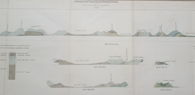
| Middle section of the 38-inch cross-section |
 |
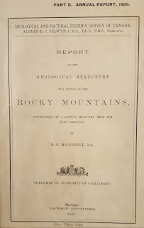
| Cover |
This Tectonic Tuesday is also an example of the History of Geology.
“The thrust producing these crustal movements and dislocations came from the west, and must have been highly energetic in its action, as some of the breaks are of huge proportions, and are accompanied by displacements of many thousands of feet. The faulted region is now about twenty-five miles wide, but a rough estimate places its original width at over fifty miles, the difference indicating the amount of compression is has suffered.”
With these words, R. G. McConnell was the first geologist to report the interpretation of low-angle thrust faults with significant throw in the western Cordillera of North America. McConnell’s study, entitled “Report on the Geological Structure of a portion of the Rocky Mountains,” was published in 1887 by the Geological and Natural History Survey of Canada. These cross-sections, near the 51st Parallel, accompanied the report. They document work during the field season of 1886, which was primarily spent in compiling a general geologic section along the line of the Canadian Pacific Railway.
The section begins on the right at Devil’s Gap, east of Devil’s Lake (now Lake Minnewanka) and extends westward toward Banff. Cascade Mountain, labeled on the section, is just north of Banff and rises to 9836 feet above sea level. The profile then approximately follows the railway up the valley of the Bow River, past Laggan (now the community of Lake Louise), and over the Continental Divide at Kicking Horse Pass. Cathedral Mountain (10,464 ft) and Mount Stephen, shown on the section, are just west of Kicking Horse Pass. The Burgess Shale, classic locality for soft-bodied Cambrian fossils, was discovered in 1909 by Chares D. Wolcott about three miles north of the summit of Mt. Stephen.
 |
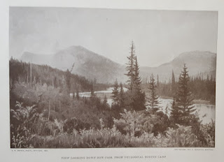
| Frontispiece |
When later geologists defined the continuity of individual thrust faults in the Canadian Rockies, one of the major thrusts was named for McConnell. The photo of the Geological Survey Camp, used as the frontispiece of this report, was actually taken during Dawson’s surveys a few years later. Dawson’s work was generally in country to the south of that described by McConnell.
When I found this report in a used book store, it was falling apart – covers off, pages torn, and the edges of the loose, folded cross-section were severely damaged. Unfolded, the plate with the cross-sections is 10”x38” and it is hand-colored. The plate is shown below.
 |
| Entire plate |

No comments:
Post a Comment